A land elevation survey measures the height of a property’s surface in relation to a fixed point. It plays a crucial role in construction, drainage planning, and flood risk assessment. Without accurate elevation data, property owners and developers could face costly errors and safety risks. This article explains what a land elevation survey is, why it’s important, and when you might need one.
What Is a Land Elevation Survey?
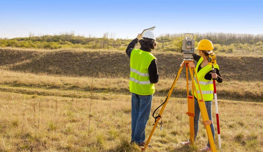
A land elevation survey determines the height variations across a piece of land. Licensed surveyors use specialized tools to map elevation changes and create detailed contour maps.
Tools Used in Elevation Surveys:
- GPS and LiDAR: Provide precise elevation data using satellite and laser technology.
- Total Stations: Measure angles and distances for accuracy.
- Leveling Instruments: Help surveyors establish elevation points.
- Drones: Provide aerial mapping and 3D elevation models for large areas.
This survey ensures that land is properly graded for construction, drainage, and environmental compliance.
Why Are Land Elevation Surveys Important?
Land elevation surveys are essential for several reasons:
- Construction Planning: Ensures stable foundations by identifying elevation changes.
- Drainage Management: Prevents flooding and erosion by assessing water flow patterns.
- Flood Risk Assessment: Helps determine if a property is in a floodplain and affects insurance rates.
- Zoning and Permits: Many municipalities require elevation surveys for building approvals.
- Land Development: Helps engineers and architects design projects that match the land’s natural features.
When Do You Need a Land Elevation Survey?
Several situations require a land elevation survey, including:
- Before Construction: Ensures the site is level and suitable for building.
- Buying Property in Flood-Prone Areas: Helps buyers understand potential risks.
- Applying for Building Permits: Some local regulations mandate elevation surveys.
- Resolving Property Disputes: Useful in legal cases involving land elevation differences.
- Landscaping Projects: Ensures proper grading for water runoff and soil stability.
How Is a Land Elevation Survey Conducted?
The process involves several steps:
- Planning: The surveyor reviews project requirements and gathers existing data.
- Data Collection: Using GPS, LiDAR, drones, and leveling tools, the surveyor records elevation points.
- Mapping: The collected data is used to create contour maps showing elevation changes.
- Analysis: Engineers and developers use elevation data to assess risks and make design decisions.
- Report Generation: The final report provides detailed elevation data for decision-making.
Costs and Factors Affecting a Land Elevation Survey
The cost of an elevation survey depends on various factors:
- Property Size: Larger areas require more data collection and analysis.
- Terrain Complexity: Hilly or uneven land increases survey difficulty.
- Technology Used: Advanced tools like LiDAR and drones may add to costs.
- Surveyor’s Experience: Highly skilled professionals may charge higher fees.
- Location: Urban areas with complex regulations may have higher survey costs.
Typical land elevation surveys cost between $500 and $2,500, depending on these factors.
Choosing the Right Surveyor for Your Project
To ensure accuracy, consider these factors when hiring a surveyor:
- Experience and Licensing: Verify the surveyor’s credentials.
- Technology and Methods Used: Modern tools provide better accuracy.
- Client Reviews: Look for customer feedback on reliability and professionalism.
- Service Scope: Ensure the surveyor specializes in elevation assessments relevant to your project.
Hiring a skilled surveyor ensures high-quality results and compliance with regulations.

A land elevation survey provides critical information for construction, drainage, and flood management. If you’re building a home, buying land, or applying for permits, knowing the land’s elevation helps you make better decisions. A professional surveyor can ensure accurate data, helping you avoid costly mistakes. Elevation data also supports smart land planning, leading to safer and more sustainable development.