You may have seen news stories about drones causing airport delays or safety concerns. Even when those events happen far away, they still affect rules here in the United States. And yes, they affect drone surveying.
If you are building a home, starting a commercial project, planning a solar site, or developing land, this matters to you. Your project depends on timing. It depends on approvals. Most of all, it depends on accurate data. When airspace rules tighten, survey work must adjust.
So even though the news may feel far away, the impact reaches local projects quickly.
Denver’s Airspace Is Already Busy
Denver continues to grow. New neighborhoods expand. Buildings rise. Roads improve. Solar projects spread across open land. Because of this growth, demand for drone surveying keeps rising.
At the same time, Denver sits in busy airspace. Hospitals, highways, events, and emergency flights all share the sky. For that reason, officials watch drone activity closely.
When global drone incidents make headlines, regulators often respond with more caution. They may review policies. They may increase enforcement. They may tighten procedures.
This does not stop professional drone surveying. However, it does mean survey teams must plan carefully. They check airspace earlier. They secure approvals in advance. They build extra time into schedules.
For clients, that careful planning helps prevent delays.
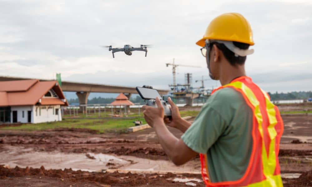
Drone Surveying Is More Professional Than Ever
Years ago, many people saw drones as simple flying cameras. Today, drone surveying works at a much higher level.
Pilots must hold FAA certification. Drones must meet federal rules. Flights must be logged. Insurance must stay active. Safety plans must be clear.
Because of global drone incidents, regulators expect even more accountability. As a result, professional standards continue to rise.
In Denver, drone surveying now combines aviation knowledge with engineering skills. Surveyors confirm coordinate systems. They check vertical elevations. They test GPS accuracy. They connect aerial data with ground control when needed.
Instead of creating problems, these stronger rules improve quality.
Why This Matters for Your Project
Let’s connect this to real work on the ground.
If you need a topographic survey before design, accurate elevations guide drainage and grading. If you plan earthwork, volume numbers must stay precise. If you track construction progress, lenders expect reliable reports.
Drone surveying supports all of these tasks. However, tighter oversight means teams must monitor airspace closely. Temporary flight restrictions can appear because of public events or emergency response. Certain areas may require approval before flying.
A skilled survey team checks these issues daily. They adjust quickly. They keep clients informed.
Because of this preparation, your project stays on track.
Stronger Oversight Builds Trust
Public opinion also plays a role. When people see drone incidents in the news, they may feel unsure about drones flying nearby.
Professional drone surveying firms respond by staying clear and transparent. They show credentials. They follow privacy rules. They operate safely. They communicate when needed.
In a growing city like Denver, trust matters. Construction already brings noise and activity. Safe drone operations reduce extra concern.
Over time, clear communication builds confidence in both the technology and the team using it.
Risk Management Is Now Part of Drone Surveying
Today, drone surveying does more than capture images. It helps manage risk.
Accurate maps reduce grading mistakes. Clear boundary data prevents disputes. Verified elevations protect drainage plans. Detailed records support lenders and inspectors.
Because global drone incidents have led to stronger oversight, survey teams now pay close attention to compliance and data quality. They treat safety and accuracy as equal priorities.
That approach protects your schedule and your budget.
Experience Matters in Denver
As Denver continues to expand, projects become more complex. Urban sites require tight coordination. Renewable energy projects cover large areas. Infrastructure work demands detailed mapping.
Drone surveying remains one of the fastest and safest ways to collect site data. It reduces time in traffic. It lowers risk on rough ground. It provides full-site views that ground crews alone cannot match.
However, today’s environment requires experience.
An experienced drone surveyor understands aviation rules and engineering needs. They check airspace carefully. They confirm vertical control. They deliver data that engineers and contractors can trust.
That preparation keeps work moving smoothly.
Looking Ahead
Global drone incidents will continue to shape how authorities manage airspace. Oversight will likely stay strong. Documentation will remain important.
Yet drone surveying in Denver is not slowing down. In fact, demand continues to grow because the technology saves time and improves safety.
The difference now lies in how professionally teams operate.
For property owners, developers, and contractors, the message is simple: drone surveying still offers speed and accuracy. However, it now requires careful planning and strong compliance.
When handled correctly, these higher standards protect your project.
And in a fast-growing city like Denver, that protection matters.