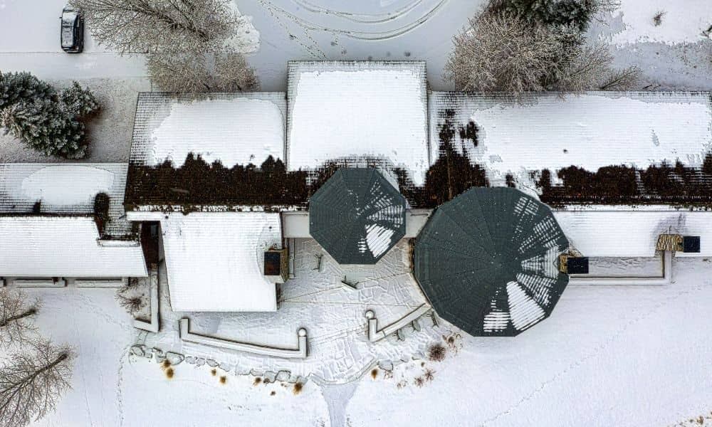
You may have seen recent storm footage showing snow and ice across Texas. The images look calm from above. Roofs appear white and quiet. Parking lots look frozen but still. However, what those aerial clips do not show is the structural stress hiding underneath. In Fort Worth, winter storms do not last long. Ice forms fast. Then temperatures rise quickly. Because of that rapid shift, buildings and soil go through sudden stress. That is exactly when a drone survey becomes critical.
Storm damage does not always look dramatic. In fact, the most expensive problems often start small.
Ice Does More Than Make Roads Slippery
When ice builds up on flat commercial roofs, it adds weight. Many retail centers and warehouses in Fort Worth use low-slope roofing systems. These roofs hold water longer than pitched roofs. Add ice into the mix, and the load increases fast.
From the ground, everything may look fine. Yet above, slight sagging can begin. Drainage points may clog. Water can pool in areas that usually drain well.
At the same time, North Texas soil creates another risk. Fort Worth sits on clay-heavy soil. Clay expands when wet and contracts when dry. During a freeze, the ground tightens. Then, when temperatures rise, it shifts again.
Because of that movement, fences lean. Retaining walls feel pressure. Pavement cracks widen. Small shifts can affect boundary markers and grading.
So while the snow melts within days, structural stress can remain.
The Freeze–Thaw Cycle Creates Hidden Damage
Unlike northern states, Fort Worth does not experience steady winter conditions. Instead, temperatures often swing quickly. One day brings ice. The next day brings sun and meltwater.
That rapid change matters.
As ice melts, water flows in new directions. Areas that never held standing water before may start pooling. Low spots in parking lots become visible. Drainage swales may not perform as expected.
For construction sites, this becomes even more serious. If a site has exposed soil or partially completed grading, meltwater can reshape surfaces. Minor erosion can change elevations just enough to affect future concrete or asphalt work.
That is why timing matters. A drone survey within 48 to 72 hours after a storm captures these changes before crews make repairs or before evidence disappears.
What a Drone Survey Reveals After a Storm
Many property owners rely on ground inspections. However, ground inspections only show what someone can see from eye level. A drone survey provides a full overhead view and measurable site data.
First, it maps the entire roof surface. It identifies ponding areas, sag lines, and debris clusters. Instead of guessing, owners see exact locations and sizes of trouble spots.
Next, it captures high-resolution images of parking lots and access drives. Cracks, joint separation, and surface heaving become clear when viewed from above.
In addition, a drone survey builds a surface model of the property. This model shows subtle elevation shifts. Even small settlement or soil expansion appears in the data.
Most importantly, it records water flow paths. After melting, water leaves marks on the ground. The drone captures those patterns before they fade. That information helps engineers confirm whether drainage systems still perform correctly.
Insurance and Documentation Matter More Than Ever
Storms often lead to insurance claims. Yet without clear documentation, disputes can arise.
If a roof already had minor sagging before a storm, an adjuster may question when damage occurred. If pondering appears weeks later, the timeline becomes unclear.
Therefore, property owners benefit from immediate documentation. A drone survey provides timestamped aerial records. It shows site conditions shortly after the event.
Because the data includes measurements, it strengthens claims. It also helps contractors explain necessary repairs with confidence.
Instead of relying on smartphone photos, owners receive scaled, professional visuals that support financial decisions.
Construction Sites Face a Different Type of Risk
Fort Worth continues to grow. New neighborhoods expand west and north. Commercial centers rise along major corridors. Many of these projects involve active grading and earthwork.
When ice hits an unfinished site, risk increases.
Stockpiles shift. Slopes soften during melt. Temporary drainage channels clog. Even a small change in grade can affect slab elevations or paving thickness later.
Before crews restart work, developers need confirmation. A post-storm drone survey compares current elevations to previous data and shows whether grading still matches the original plan. That way, a project manager can sit down with their drone survey team, review updated maps, and make informed decisions before heavy equipment moves back onto the site.
This simple step prevents costly rework. It also protects schedules. In fast-moving projects, delays quickly increase labor and material costs.
Fort Worth Has Unique Structural Vulnerabilities
Not every city faces the same conditions.
Fort Worth experiences wide temperature swings in winter. Buildings often feature large flat roofs. Many commercial areas include expansive parking lots with complex drainage.
Additionally, clay soil reacts strongly to moisture. During freeze–thaw cycles, movement happens fast.
Because of these factors, small storms can create bigger impacts than expected. While northern states design structures for long snow seasons, Texas buildings may not face heavy ice often. Therefore, even moderate accumulation can introduce stress.
A drone survey helps property owners stay ahead of these risks.
Waiting Can Increase Costs
After a storm, many owners choose to wait. They assume everything looks fine. However, small issues can grow quietly.
Water trapped on a roof can weaken materials. Minor cracks can widen with traffic. Soil shifts can stress foundations slowly over time.
Meanwhile, evidence fades. Meltwater evaporates. Crews begin patching surfaces. Weeks later, determining the original condition becomes harder.
For that reason, quick action makes financial sense. A short flight and clear mapping often cost far less than one structural repair.
Who Should Consider a Drone Survey After Ice or Snow?
Commercial property owners with flat roofs benefit greatly. Warehouse operators with large square footage face similar risks.
Developers with active grading or slab preparation need updated site data. HOA boards managing multi-building communities also gain peace of mind.
Even residential investors with multiple properties can use a drone survey to protect assets.
If ice covered your site recently, consider documentation now rather than later.
From Viral Storm Footage to Smart Risk Prevention
Storm drone videos may circulate online. They show frozen trees and white rooftops across Texas. Yet for property owners, the story goes deeper.
Ice and rapid melt can create structural stress, drainage shifts, and soil movement. These changes often remain invisible from the ground.
A well-timed drone survey turns uncertainty into measurable information. It provides clarity before insurance discussions, before construction resumes, and before small issues grow into major repairs.
Snow melts quickly. However, structural risk does not.
Acting early protects your schedule, your budget, and your investment.