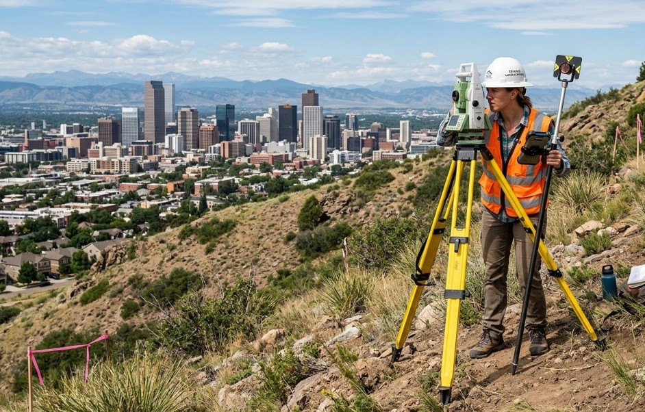
If you’re planning a construction or land development project, a topographic survey is one of the most important first steps. It gives you a clear picture of your land, including elevation changes, slopes, and natural features.
In Denver and nearby areas, land conditions can vary greatly. From flat lots to sloped terrain, understanding your property before building helps you avoid costly problems later.
What Is a Topographic Survey?
A topographic survey maps the surface features of your land. It shows both natural and man-made elements.
This includes:
- Elevation and contour lines
- Trees, slopes, and hills
- Buildings and structures
- Roads, fences, and utilities
With a topographic survey, you get detailed information that helps guide your project design.
Why a Topographic Survey Matters
Building without understanding your land can lead to serious issues. A topographic survey helps you plan with confidence.
It allows you to:
- Design proper drainage systems
- Plan building placement
- Avoid flood-prone areas
- Reduce unexpected site issues
This step is essential for both small residential projects and large developments.
Local Factors That Affect Projects in Denver
Denver has unique conditions that make topographic surveys especially important.
1. Sloped Terrain
Many properties have varying elevations. Without proper mapping, it’s easy to misjudge how steep a site is.
2. Drainage Concerns
Rain and snowmelt can affect how water flows across your land. A survey helps identify areas where water may collect.
3. Changing Elevation
The landscape in the area can shift from flat to uneven quickly. Accurate data ensures your design fits the land.
4. Growing Development
As more projects take place, detailed surveys help ensure new builds fit well within existing surroundings.
When Do You Need a Topographic Survey?
You may need a topographic survey if you are:
- Building a new home or structure
- Planning land development
- Adding driveways or outdoor features
- Designing drainage or grading systems
It’s best to complete this survey before finalizing your plans.
How Surveyors and Engineers Work Together
A topographic survey is often used by:
- Civil engineers
- Architects
- Contractors
The data collected helps these professionals design safe and efficient projects. Without it, plans may not match real site conditions.
What to Look for in a Surveying Company
Choosing the right surveyor ensures accurate results.
Modern Equipment
Look for companies that use updated tools for precise measurements.
Clear Reports
Your survey should be easy to understand and detailed enough for planning.
Local Experience
Surveyors familiar with Denver understand the area’s terrain and challenges.
Reliable Service
Timely delivery is important to keep your project on schedule.
Why Hiring Local Matters
Working with a local surveyor offers key benefits:
- Faster site visits
- Knowledge of local land conditions
- Understanding of regional requirements
This helps your project move forward smoothly.
Common Mistakes to Avoid
Skipping a topographic survey can lead to:
- Poor drainage planning
- Incorrect building placement
- Unexpected grading costs
- Delays during construction
Even smaller projects can benefit from accurate land data.
Planning Your Project the Right Way
Before building, take time to understand your land. A topographic survey gives you the information needed to make smart decisions.
If you’re unsure where to start, working with a trusted team like Denver Land Surveying can help guide your project from the beginning.
Soft Call-to-Action
Every successful project starts with good planning. If you’re preparing to build or develop, consider reaching out to a local surveyor to learn how a topographic survey can help you move forward with confidence.