Florida homeowners, buyers, and builders are seeing big changes this year. New flood maps released by FEMA are changing how flood risk is measured across the state. Because of this, many properties now face new rules. As a result, a FEMA elevation certificate has become more important than ever.
Even if your home has never flooded, your flood zone may have changed. This can affect your insurance costs, building permits, and even your loan approval. So, understanding what these new maps mean can help you avoid delays, stress, and surprise costs.
Across Florida, many homeowners are learning that their properties now fall into different flood zones. This does not mean your home is unsafe. However, it does mean lenders, insurers, and city offices now need clear proof of elevation and flood compliance.
Why Florida’s Flood Maps Were Updated
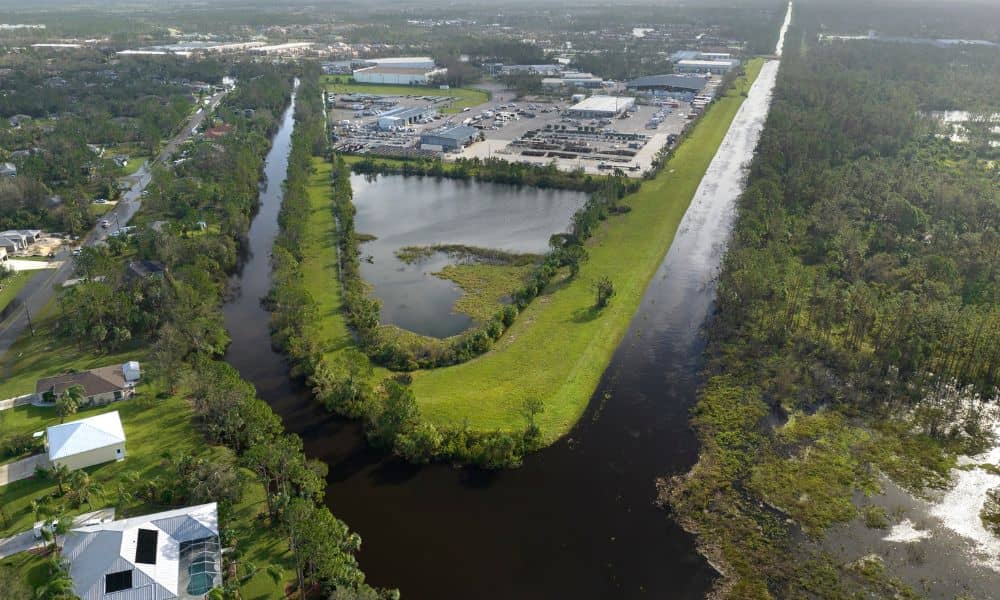
Florida grows fast. New homes, roads, and shopping areas change how water moves across the land. Because of this, FEMA updates flood maps to match current conditions.
Recently, FEMA used better tools and new data to improve these maps. They looked at rainfall, storm surge, drainage systems, and land changes. Because of that, flood zone lines moved in many areas.
These updates help protect people and property. Still, they can surprise homeowners who think flood zones rarely change. In reality, flood zones can change often, especially in growing cities.
Because of this, many properties now need new flood paperwork. One key document is a FEMA elevation certificate, which shows how high a building sits compared to flood levels.
How New Flood Zones Trigger FEMA Elevation Certificate Requirements
When flood zones change, banks and insurance companies often ask for new elevation proof. That is when a FEMA elevation certificate becomes important.
This certificate shows exact height levels of a building. It measures the lowest floor, garage slab, and nearby ground. These numbers help decide flood risk and insurance costs.
If your home sits higher than the flood level, your insurance cost may stay low or even drop. However, if your home sits lower, your lender may require flood insurance.
In many cases, a proper elevation certificate can help prevent high insurance bills. Without it, insurance companies often assume more risk and charge more.
Why This Matters So Much for Property Owners
Florida is flat. It also gets heavy rain and storms. Because of this, flood risk can change easily. Even small land changes can affect flood levels.
Because of this, many homeowners now face new problems, such as:
- Higher flood insurance costs
- Delays in building permits
- Loan approval problems
- New building rules
Buyers can also face delays when flood paperwork is missing. Sellers may see buyers hesitate if flood risk is unclear.
Luckily, a FEMA elevation certificate gives clear proof of elevation. This helps solve these problems and makes decisions easier.
Real-Life Situations Where Elevation Certificates Become Urgent
Many people do not think about flood risk until a problem appears. Now, because flood maps changed, these problems happen more often.
One common case happens during home loans. A lender may check updated flood maps and ask for a FEMA elevation certificate. Without it, loan approval may slow down.
Another case involves insurance. Some homeowners suddenly see higher flood insurance costs. However, an elevation certificate may show their home sits high enough, which can lower that cost.
Permits also create stress. Homeowners planning to build or renovate may learn they need flood proof before getting approval.
Home sales also suffer when flood risk seems unclear. Buyers worry. An elevation certificate helps ease those worries and keeps deals moving.
What a FEMA Elevation Certificate Actually Shows
Many people think this document only measures ground height. In fact, a FEMA elevation certificate includes several important numbers.
It shows the height of the lowest floor, garage floor, nearby ground, and flood level set by FEMA. These numbers help decide flood risk and insurance cost.
Because these details matter so much, they must be accurate. Even small mistakes can lead to higher costs or permit problems.
That is why only licensed land surveyors can prepare this document.
How Licensed Surveyors Collect Accurate Elevation Data
Licensed surveyors follow clear steps to get accurate results. First, they set official height points using trusted systems. Next, they use special tools to measure the building and nearby land.
After gathering the data, they fill out FEMA’s official forms. They check everything carefully before sending the report.
This careful process helps make sure the certificate meets city, lender, and insurance rules. More importantly, it protects homeowners from delays and extra costs.
Common Mistakes That Lead to Delays and Extra Costs
Some homeowners try shortcuts to save time or money. Sadly, these choices often cause bigger problems later.
One mistake involves using old building plans instead of current measurements. Land conditions change, so old plans may not match real conditions.
Another mistake involves using unlicensed workers. FEMA only accepts documents from licensed surveyors, so these reports often get rejected.
Missing or incorrect paperwork also causes delays. When forms are incomplete, surveyors must return, which adds time and cost.
Working with a licensed surveyor from the start helps avoid these problems.
How to Know If You Now Need a FEMA Elevation Certificate
You may need a FEMA elevation certificate if:
- You are buying or selling a home
- You are refinancing
- You plan to build or renovate
- Your flood insurance cost increased
- Your lender asked for flood documents
If any of these apply, getting clear elevation data can help you move forward with confidence.
Why Acting Early Saves Time, Money, and Stress
Flood rules in Florida continue to change. Because of this, early planning helps a lot.
Getting a FEMA elevation certificate early helps avoid last-minute delays, rushed scheduling, and surprise bills. It also helps you make smart choices about insurance and building plans.
With clear elevation data, you can move forward knowing where you stand.
Final Thoughts
Florida’s new flood maps are changing how homeowners, buyers, and builders deal with flood risk. Because of this, the FEMA elevation certificate now plays a key role in loans, permits, and insurance decisions.
By understanding these changes and acting early, you can protect your home, control costs, and avoid stress. With proper elevation data, you gain peace of mind and clear direction — no matter what the flood maps show.
If your property may be affected, a licensed land surveyor can help prepare accurate documents and guide you through the process.